How are we affected, and what can we do to support the areas impacted?
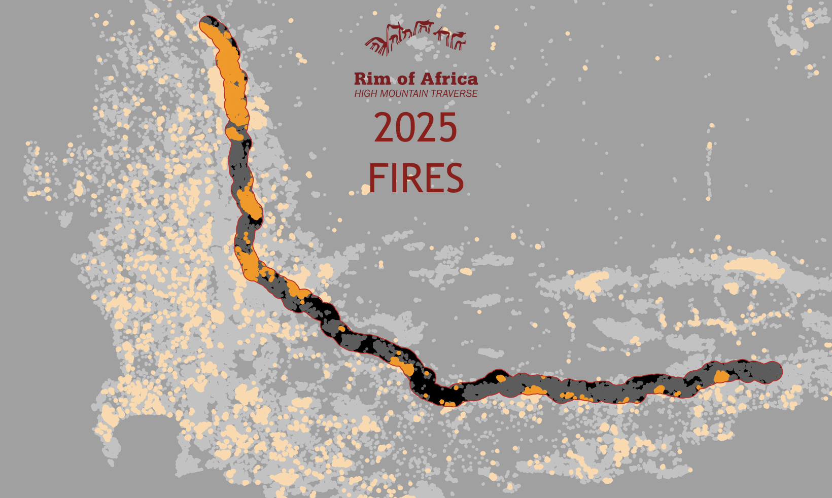
Every year fires work their magic and some destruction in the fynbos. Last year (2025) saw more than 100,000 hectares of veld burn in the Cederberg (the large orange blob in the north). Much of that area had not burnt for more than 10 years(the grey dots represent the last twelve years of fires). In March of 2025 there was a fire in the northern Cederberg which meant that we re-routed Traverse 1 in that vicinity, then in December 2025 the southern section burnt when a vehicle caught fire. Most likely this year we will return to our default route for the start of T1 2026 and need to adjust the southern parts of T1 to avoid more sensitive burnt areas.
While human actions do start many of the fires in the fynbos, we also control them to some extent. Fragmentation of the veld by agriculture and roads tends to stop widespread fires, which tend to occur in extensive wilderness areas. Regardless of the necessity of fires for the health of the ecosystem, we should do everything we can to avoid them. For this reason we forego campfires, discourage smoking and forbid the burning of rubbish on the Traverse.
Alien vegetation, especially invasive pines, burn hotter and longer, damaging the environment and infrastructure. Look out for Rim of Africa’s new Mountain Restoration projects that seek to clear the scattered wilding pines from the peaks along our route.
For this map we downloaded VIIRS hotspots from NASA (2012-2025) and buffered the Rim of Africa Traverse to represent a 10km wide corridor along our 700km high mountain traverse.